TECH Meets BUSINESS

The AIST venture company Research Institute for Earth Science Visualization Technology Co.,Ltd. (hereafter referred to as “Chikyugiken”) carries out outdoor surveys and research into earth science, and is engaged in research and development of technologies for visualization of the research results. This is a very rare venture company that started from the geological museum field, and in order to produce the “museum of the future” they visualize the permanent history of the earth using the most advanced manufacturing technologies.
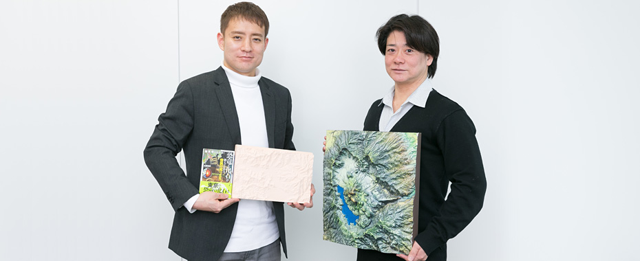
CEO and Representative Researcher of Research Institute for Earth Science Visualization Technology Co.,Ltd. (Chikyugiken). Graduated in Natural Science from Tsukuba University, and completed his master's degree course (Graduate School of Life and Environmental Sciences) at the same university. After being a doctoral student at Tsukuba University and a Postdoctoral Researcher at AIST, from 2011 he was assigned to the AIST Geological Museum as Curator. In 2016 he established the Research Institute for Earth Science Visualization Technology Co.,Ltd. as an AIST venture company, and was appointed as its Representative. He is the author or editor of several books, including “The Prehistoric Life Map of the World” (2016, X-Knowledge).
Deputy Representative (Director) of Research Institute for Earth Science Visualization Technology Co.,Ltd.. After graduating from the Faculty of Law of Seikei University, he worked with a general insurance company, and then joined Nishimura Seimitsu Chikei Mokei (Nishimura Precision Topographical Models) . In 2001 he became Representative of that company, which became incorporated in March 2007. In June 2016 while cooperating on preparation of a program for NHK, he established a good working relationship with Akihiko Shibahara. They founded the Research Institute for Earth Science Visualization Technology Co.,Ltd., and was appointed Deputy Representative.
“A television program that led to the founding of Chikyugiken, and an encounter between two researchers and scientists”
― I hear that a television program led to the opportunity to establish the company, tell us about what happened.
I was once a specialist in fossil research, and was Curator of the AIST Geological Museum. I prepared various precision topographical models of land and seabed, etc., and researched projection mapping for the results of my own surveys and the geological maps of the Geological Survey of Japan, AIST. However at that time the models I had prepared were about 30 cm square, but the television program required models about 3 m square. This was not something I could produce by myself, but in talks with Roland DG Corporation who have experience in producing models, I was introduced to Mr. Daidoji who had the most advanced technology in Japan for producing models.
Kaku Daidoji (hereafter, Daidoji):When I initially heard the discussion I refused. I had experience of combining models and projection mapping, but I considered that it was not possible to apply projection mapping to such large models. However I heard that Mr. Shibahara had the technology for accurately plotting an image on a model while distorting the image. I was surprised by this, and said “let’s try it out”.
We got on well at the meetings regarding the program, firstly we succeeded in planning the program, then afterwards we spoke about doing something together. In the program projection mapping was performed on a 3 m square 3-dimensional model of Tokyo, and we succeeded remarkably in showing underground and other land features of Tokyo. The audience rating was high, and we heard that it was broadcast again several times.
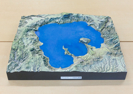
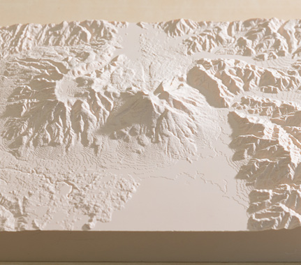
3D color mapping model (Lake Towada)
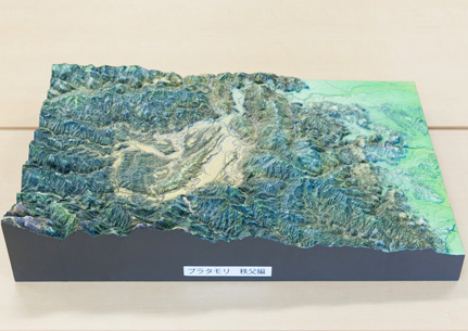
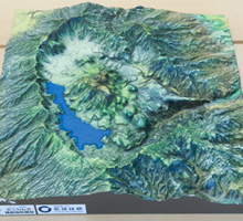
3D color mapping model (Chichibu)
― After completion of the program, what prompted you to start up the company?
We were just two people with nothing in common except some outrageous ideas, but gradually through negotiations the plan got under way. Initially we were thinking of carrying out a project together, rather than starting the company.
Daidoji:When the idea of doing this with models was presented, the level of enthusiasm increased even higher, and Mr. Shibahara as a researcher had an extraordinary level of passion and motivation.
Shibahara:The decision to start up the company was made because the time was right, rather than for any one reason. After the NHK program was broadcast many requests came pouring in, which we initially dealt with the requests on a volunteer basis. However this reached the limit, and at that point we said we have to start a company, which we did in 2016.
“Unprecedented large-scale precision 3D models and subtle projection mapping”
― What is the set up in the company at present?
There is just the two of us, Deputy Representative Daidoji and I. We come from different fields, but that which we have in common is 3D models. We conduct our research utilizing this to the maximum extent, while stimulating each other.
Daidoji:Of course in order to expand the business we will need staff, but we are proceeding by obtaining the help and cooperation of our friends. Working closely with Mr. Shibahara and having our friends join us without being aware of the company as a barrier, that is the strength of Chikyugiken.
― At present you have a geological model of the Japanese Archipelago on display at the AIST Geological Museum, don’t you?
Mr. Daidoji was responsible for preparing the large-scale models, and I prepared the contents for projection mapping. In the era of open data, coordinate data points are accumulated and made public, be it a single data point or several billion points. I think that efficiently processing large quantities of data with limited resources and dropping it into projection mapping is where I can show my skill.
Daidoji:Normally when projection mapping is performed on 3D models, the image is distorted. However, the method for correcting this distortion developed by Mr. Shibahara has extremely high accuracy, and projection onto large models can be performed accurately. At present a 9 m square 3D model of the Japan is on display at the AIST Geological Museum.
Shibahara:With a 9 m square model projection mapping is impossible with a single projector, so the operation was divided among 5 projectors. Linking and adjustment was extremely difficult, but we were able to achieve it with some help from our friends.
“Redefining museum to create the museum of the future!”
― What are the important things regarding running the company?
I think that the importance of achieving a profit and technical development are the same as for any company. However with us it does not end after we have produced and sold a model, we have the idea that we want to see where it has been delivered to the customer. Our technology is now reaching various fields such as social infrastructure, disaster prevention, and urban planning, and not only natural science.
Daidoji:We both think that if we are not interested in a job we do not want to do it, and we made that promise when we started the company. What we want to do is enjoy research and development, do that which we enjoy, and astonish the people of the world.
― Tell us about your vision for the future.
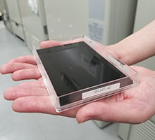
There are many methods of representation for visualization in natural science, and we want to further increase this number. We have already produced a product for projection mapping onto a 3D model, in which a tablet is separately prepared, and if children draw pictures on the tablet that picture is projected onto the model. We want to develop methods of representation that are more visual and more easily understood, by incorporating artificial intelligence.
Shibahara:Our ultimate aim is to produce a museum of the future. The museum will collect many types of information on its locality, so for example by viewing the models with projection mapping, an environment will be created for discussions regarding new urban development or disaster prevention. Geological specialists and the general public can participate in this, and discuss on an equal footing. Such a place would redefine the concept of a museum, and become a bed of innovation.
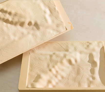
Precision topographical model (Mount Bandai)
Precision topographical model for understanding the underground structure (Kobe to Nishi Osaka)
* The contents of this article are based on information as of March 1, 2018.
![]()
地球科学可視化技術研究所株式会社
〒305-0047 つくば市千現二丁目1番地6
Research Institute for Earth Science Visualization Technology Co.,Ltd.
2-1-6 Sengen, Tsukuba City, Ibaraki Prefecture, Japan 305-0047
Research Institute for Earth Science Visualization Technology Co.,Ltd.
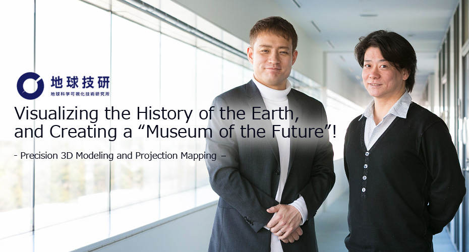
Visualizing the History of the Earth, and Creating a “Museum of the Future”!
- Precision 3D Modeling and Projection Mapping –
Mottainai Energy Co., Ltd.
Brightening the Future with Electricity Produced from Heat!
LEAG Solutions Corporation
New image measurement for the smart society!
- 3D position and attitude measurement using high-accuracy markers -
HikariPath Communications Co., Ltd.
Realtime 4K video eliminates distance using new optical communication technology!
Trimatiz Limited
Manipulating light to open up the future! Technology for measuring the unknown underwater world
Nanolux co. ltd.
Deliver Color Images in Darkness! Unique Technology Enabling Color Image only by Infrared Illumination
SteraVision Co.,Ltd.
Realizing an Eye that can See like a Human!
– Development of Optical Steering Device and New Standard Lidar -
ProteoBridge Corporation
Reproduce human on the palm !
-Development of the world's first human protein array-
Site Sensing Inc.
Expanding a New Business with Excellent Measurement Technologies for Tracking, 3D Modeling , and Face Recognition
Hmcomm Inc.
Controlling Voice to Open Up Next Generation Business!
- Commercializing AI and Voice Recognition Technology -
TOKIWA-Bio Inc.
Automatic Generation of iPS Cells!
- Contributing to Gene Therapy Worldwide -
HSP Technologies Inc.
Producing New Materials by Mixing Materials that do can not Mix!
MIRAISENS,Inc.
A feeling as if things were really there!
~ Digitization of physicality and bodily sensations ~
PicoTherm Corporation
Supporting information society by technology to measure thermophysical properties
EDP Co.
Dedication to the ultimate material, diamond

Marketing and Business Development Headquarters
Startups Promotion and Technology Transfer Division
Tsukuba Center1, 1-1-1, Umezono, Tsukuba, Ibaraki 305-8560, JAPAN
E-mail:dsu-koho-ml@aist.go.jp