Organization
Outline of the Research Institute of Geology and Geoinformation (IGG)
Geological information is basic information on the land and the surrounding seas, which has been systematically compiled through geoscientific research. The Research Institute of Geology and Geoinformation (IGG) conducts geological surveys for terrestrial and marine geological maps and geoscientific maps to be useful in society, and provide authentic geological information in accordance with Japanese Measurement Standards and Intellectual Infrastructure Development Plan. In particular, the Institute organize geological information for urban areas and their coastal areas to reduce the risk and impact of natural disasters in urban areas. Researches for the development, integration, and advanced use of geological information in Asia are also conducted to resopond to the international needs.
Messages from the Director

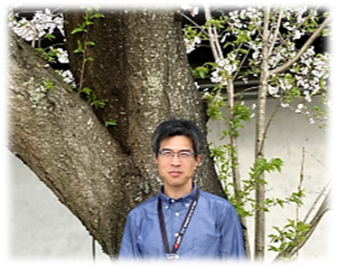
Director, Atsushi NODA
The Earth has a long and dynamic history. Even its subtle movements can significantly impact our lives in the form of natural disasters. At the same time, the Earth also provides us with essential benefits such as resources, energy, and a sustainable global environment.
The Research Institute of the Geology and Geoinformation, as a research unit of the Geological Survey of Japan, conducts geological surveys of Japan’s land and surrounding marine areas. Our mission is to support the daily lives of citizens and the country’s social and economic activities by organizing and improving geological information as part of the nation’s intellectual infrastructure. To achieve this mission, we systematically compile and provide geological information through geological maps and databases, contributing to the mitigation of geological disasters, the sustainable use and conservation of the environment.
The seven-year period of the Sixth Mid- to Long-Term Plan began in fiscal year 2025. During this period, we are placing particular emphasis on the following key initiatives:
- Continuing geological surveys of Japan’s land and surrounding marine areas, and further developing and expanding fundamental geological data
- Creating 3D subsurface geological models of urban areas using borehole and drilling data
- Developing geological information in plains and coastal regions to prepare for major earthquakes, such as those along the Nankai Trough and inland-to-coastal active faults
- Utilizing satellite data and advancing research and development related to satellite sensors to support disaster prevention, risk reduction, and the sustainable use and conservation of the environment
- Developing technologies to assess environmental impacts related to development of submarine natural resource
- Promoting the dissemination and use of geological information through digital transformation (DX), including the digitalization of data and research to enhance accessibility and application
- Strengthening international collaboration and fostering the next generation of professionals in geological surveys
Our mission is to enhance the nation’s intellectual infrastructure and strengthen industrial competitiveness. We appreciate your understanding and support, and we sincerely ask for your continued cooperation.
May 15, 2025
Organization
Staff Members
| Research Institute of Geology and Geoinformation | Director | Atsushi NODA |
|---|---|---|
| Deputy Director | Yoshinori MIYACHI | |
| Deputy Director | Atsuyuki OHTA | |
| Career Researcher | Satoshi NAKAE | |
| Joint Appointed Fellow | Makoto TAKEUCHI | |
| Concurrent post | Koki IWAO | |
| Concurrent post | Rei NAKASHIMA | |
| Concurrent post | Junko KOMATSUBARA |
Research Groups
- Quaternary Basin Research Group *
Leader, Group, Tomonori NAYA - Stratigraphy and Tectonics Research Group *
Leader, Group, Hidetoshi HARA - Orogenic Processes Research Group *
Leader, Group, Takashi KUDO - Integrated Geo-information Research Group
Leader, Group, Takayuki UCHINO - Geoinformatics Research Group *
Leader, Group, Ikuo CHO - Remote Sensing Research Group
Leader, Group, Satoru YAMAMOTO - Marine Geology Research Group
Leader, Group, Takahiko INOUE - Paleogeodynamics Research Group *
Leader, Group, Takuya ITAKI - Marine Geo-Environment Research Group *
Leader, Group, Atsushi SUZUKI - Tectonics and Resources Research Group *
Leader, Group, Mikiya YAMASHITA - Geochemistry Research Group
Leader, Group, Atsuko AMANO - Geophysics Group *
Leader, Group, Ayumu MIYAKAWA
