The History of Nasunogahara
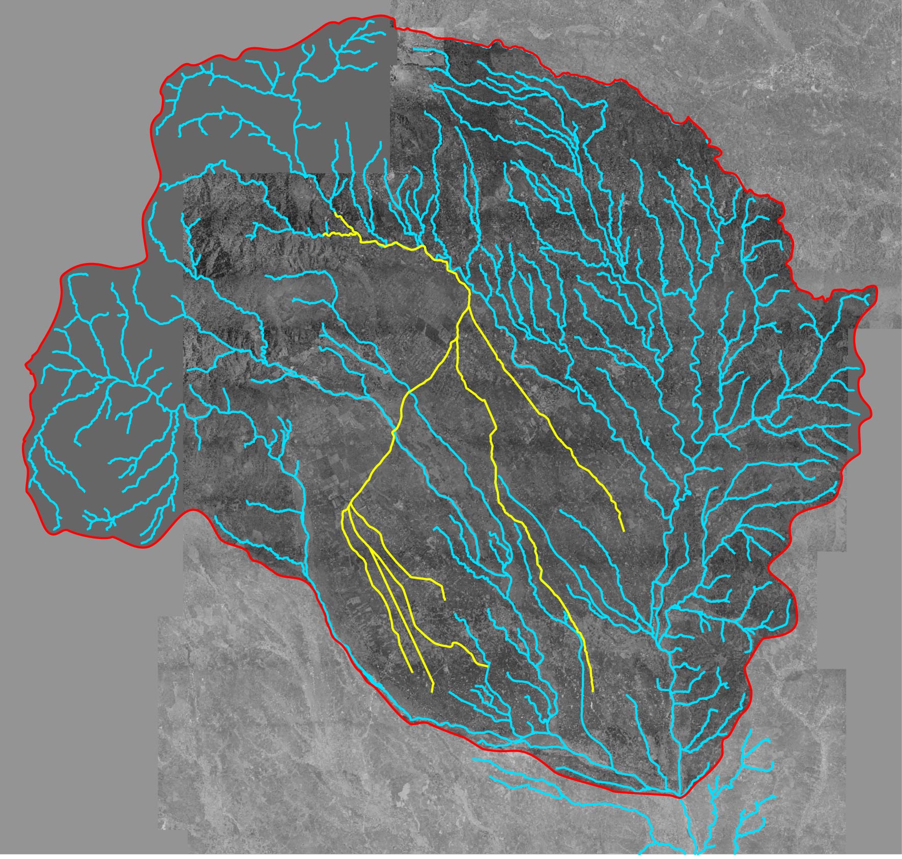
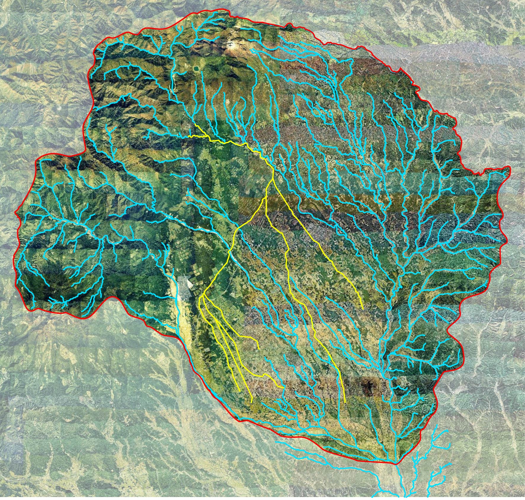
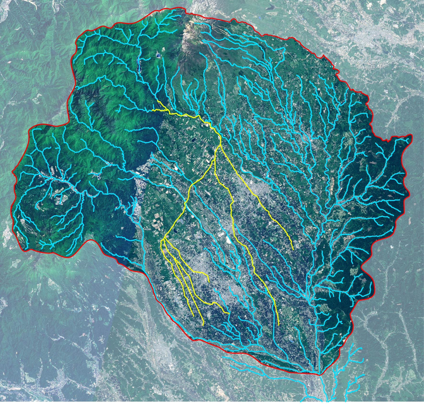
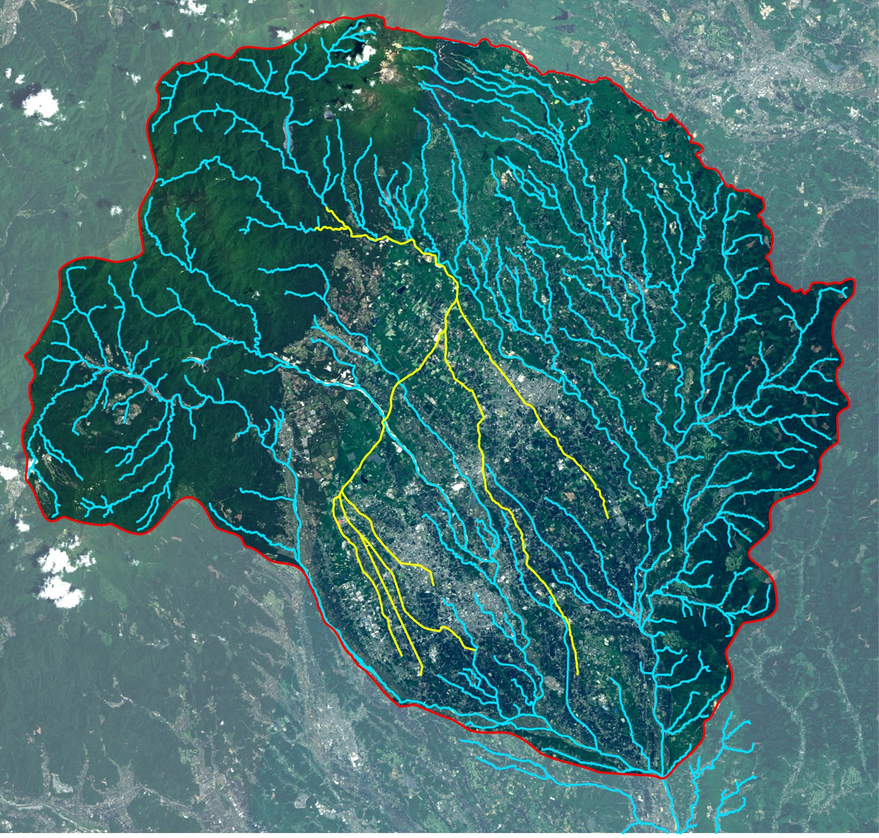
Source: Aerial photograph taken by the Geospatial Information Authority of Japan
This aerial photograph utilizes the Basic National Map (orthoimage) from the Geospatial Information Authority of Japan (GSI), Ministry of Land, Infrastructure, Transport and Tourism, with administrative boundaries and river data added.