Integrated Geo-information Research Group
Our group is mainly engaged in the creation of a 1:200,000 seamless digital geological map of Japan with its application research and basic geological mapping. Our geological information is useful for disaster prevention, resources, construction in Japan. We are also updating the geological information in Japan and provide various types of data formats so that it can be widely and effectively used by the general public.
Group Mission
Study 1: Maintenance, updating, and enhancement of the 1:200,000 scale Seamless Digital Geological Map of Japan V2
After a 1:200,000 scale geological map was published, we integrate its vectorized data to the seamless digital map and then update it with a reflection of geological minor revisions found among various districts. Additionally, we continue to enhance functions such as displaies of lithology and 3D map.
・Click here for HP of the 1:200,000 Seamless Digital Geological Map of Japan V2
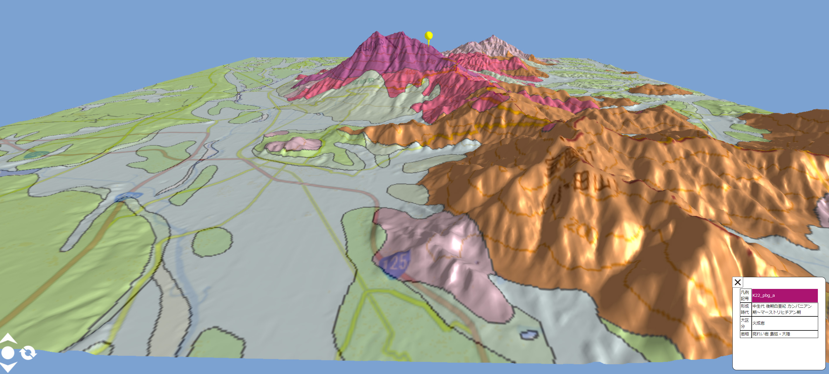
3D view of the 1:200,000 Seamless Geological Map of Japan V2
Study 2: Slope Hazard Risk Assessment Mapping (Slope-hazard Risk Assessment Project [cross-departmental])
Based on the 1:200,000 Seamless Digital Geological Map of Japan V2, we have created slope hazard risk assessment maps by integrating disaster history data, topographic data, lithological data, and geo-structural data, borehole data etc.
・Click here for HP of Slope Disaster Project
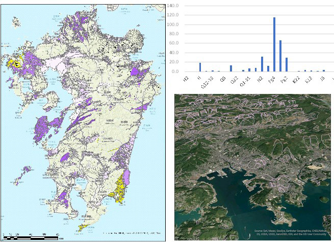
Analysis between sedimentary rocks and past landslide topography
Study 3: Geological Mapping (Geological Mapping Project [cross-departmental])
We make the 1:200,000 and 1:50,000 scale geological maps for updating the seamless digital geologic map.
・Click here for HP of Geological Mapping Project
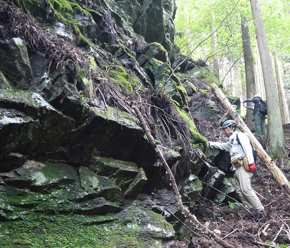
Geological survey scenery
Study 4: Other
We try to elucidate to a geological history of the Japanese Islands and standardize the newly-developed point cloud PNG file format (NISHIOKA, 2021), We are also engaged in a interdisciplinary research between geology and agriculture, and preparation of JIS A0204 and 0205 standards for geological mapping.
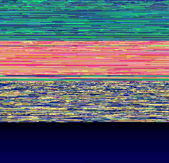
Point Cloud PNG File
Group Member
| Name | Special field of study | Other |
|---|---|---|
|
Group leader
UCHINO Takayuki
|
Accretionary Geology | research map |
| NISHIOKA Yoshiharu | Deep Rock Petrology, Intelligence Geology | |
| BANNO Yasuyuki | Petrology, Mineralogy | research map |
| NAGAMORI Hideaki | Paleontology, Sequencing | |
| KAWABATA Daisaku | Intelligence Geology, Topography | |
| ABE Tomoya | Geomorphology, Surfacing | Personal HP |
| MURAOKA Yayoi | Petrology of deep-seated rocks | |
| KATAGIRI Seira | Structural Petrology, Metamorphic Rocks | |
| TAKARADA Shinji | Volcanic Geology | (holding two posts concurrently)Personal HP |
| NAITO Kazuki | Petrology, Intelligence Geology | (holding two posts concurrently) |
| YOSHIKAWA Toshiyuki | Field Geology, Intelligence Geology | (holding two posts concurrently)Personal HP |
| IWAYA Toshimitsu | ||
| SAKAGUCHI Keiichi | ||
| HOSHIZUMI Hideo | Volcanic Geology | |
| YOSHIZAWA Kazuko | Paleontology | |
| NAGATSU Juri | ||
| IGAWA Toshie | Geology, Archaeology, Paleontology | |
| MATSUZAKI Sayoko | ||
| OKUBO Kyoko |