All registration errors which are calculated by the parallax
correction and the inter-telescope geometric correction processes are
consolidated and changed into latitude/longitude from pixel units in
the along- and cross-track directions. The latitude/longitude values
at each lattice point, which are calculated by the geometric system
correction, are corrected with the consolidated error data.
A set of positions expressed by latitude and longitude are adopted
as the geolocation data (the geometric coefficients) for each
lattice point.
Other parameters which are necessary for higher level product
generations such as Level-3 (the geocoded ortho images) data products
and the Level-4 (DEM) data products are calculated in this module,
and are appended to the Level-1A products as the header information.
Figure 2-10 shows the geometric coefficient generation flow.
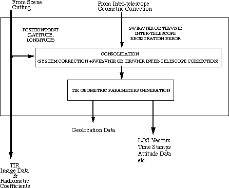
Figure 2-10 Geometric Coefficients Generation
|