|
 |
 |
ASTER keeps observation on daily basis ever since it started operation.Observed data are processed to products at GDS and registered to database for storage.User will be provided with their necessary data from the database.
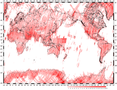
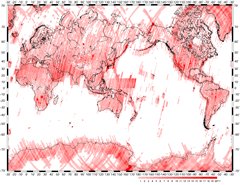
This map provides information on observed area and spots the area observed in good condition.Good condition here refers to observation of clear ground surface was achieved with cloud coverage of 20 % or less.
|
|
 |
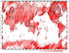
June 11th, 2003 |
|
|
 |
 |
all observed data |
cloud coverage of 20% or less |
*1 night observation included
*2 as of June 11th, 2003 |
|
|
|
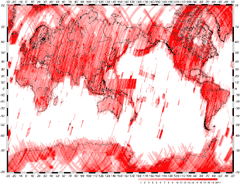
January 15th, 2003 |
|
|
 |
 |
all observed data |
cloud coverage of 20% or less |
*1 night observation included
*2 as of January 15th, 2003 |
|
|
 |
|