It used to be known that Miyagi Prefecture in northeastern Japan, heavily afflicted by the 11 March 2011 Off the Pacific Coast of Tohoku earthquake, had experienced giant tsunamis in the past.
The Jogan earthquake of 869 is chronicled in Nihon Sandai Jitsuroku, an official book of history, which states that Taga Castle (to the northeast of Sendai City), then home to a province capital, was heavily damaged by intense shaking of the earthquake and a giant tsunami. Especially, the tsunami is thought to have been considerably large in scale, and it has been thought that the earthquake was considerably larger than the Miyagi Oki (Off the Coast of Miyagi Prefecture) earthquakes that occur at approximately 40 year intervals.
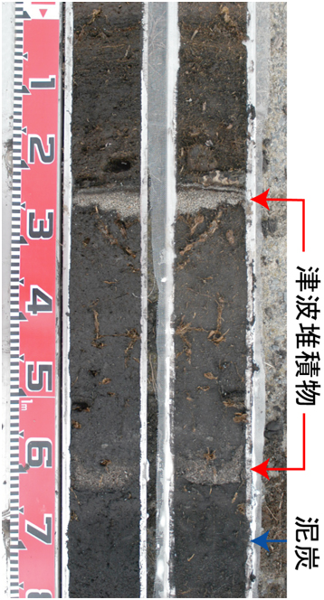
It has been pointed out by Professor K. Minoura of Tohoku University that tsunami deposits (Figure 1) are distributed over the areas flooded by this tsunami. The National Institute of Advanced Industrial Science and Technology (AIST) has played a central role in a survey and research program to reproduce this tsunami event.
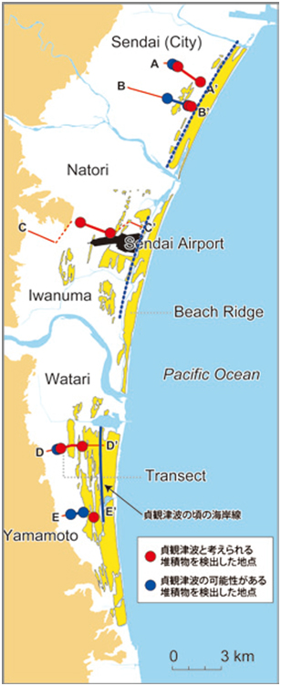
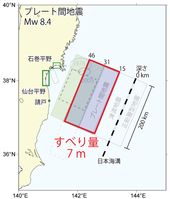
We first elucidated, through detailed investigations on land, that tsunami deposits are broadly distributed over coastal plains in Miyagi and Fukushima Prefectures (Figure 2). On the basis of these results, we have created, through simulation, a fault model for which inundation occurs just up to the tsunami deposit distribution areas (Figure 3). In our final model, we estimate that the fault rupture had a width of 100 km and a length of 200 km.
This is about half the size, in both width and length, of the fault rupture area that caused the latest event, but the tsunami deposit distribution area should be smaller than the actual tsunami inundation area, so the fault surface that actually caused the Jogan earthquake is thought to have been larger in size than AIST's Jogan earthquake fault model. Details of the above-mentioned surveys and tsunami simulation are presented in the August 2010 issue of the AFERC News (in Japanese).